


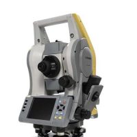
Geomax Zoom 90 Total Station
The GeoMax Zoom 90 is a total station used for land surveying and construction applications. It features advanced technology for precise measurements, including high accuracy in angles and distances.
Features:
- High-Precision Measurements:
- The GeoMax Zoom 90 offers sub-millimeter accuracy in distance measurement, which is crucial for high-precision surveying tasks. This makes it suitable for applications like land surveying, construction, and mapping.
- Fast and Reliable Measurements:
- Equipped with a high-speed EDM (Electronic Distance Measurement), it ensures fast and accurate readings over long distances, with a range of up to several kilometers depending on the prism type.
- Robotic Capability:
- The Zoom 90 can operate as a robotic total station, meaning it can be controlled remotely from a distance. This reduces the need for an additional person to hold the prism, making the surveying process more efficient and reducing labor costs.
- Laser Plummet:
- The built-in laser plummet allows for easy and accurate setup of the total station over a point without the need for an optical plummet.
- Long Battery Life:
- The Zoom 90 is equipped with a long-lasting lithium-ion battery, enabling extended operation in the field without frequent recharging.
- Tilt Compensation:
- The instrument comes with an integrated tilt sensor that automatically compensates for any tilt during measurement, ensuring accuracy even when the total station is not perfectly level.
- Intuitive User Interface:
- The device features a touch-screen interface and a simplified, intuitive menu system, allowing users to quickly perform measurements, adjust settings, and access data in the field.
- Integrated GNSS Functionality (optional):
- The Zoom 90 can be paired with GNSS receivers for combined GNSS and total station measurements, which helps to improve flexibility in geospatial data collection, especially for large projects.
- Weather Resistance:
- It is designed to withstand harsh weather conditions with IP55-rated protection, making it suitable for use in a variety of environments, from hot and dry to wet and cold conditions.
- Data Collection and Software:
- The Zoom 90 works with GeoMax’s field software, like X-Pad or FieldGenius, for efficient data collection, processing, and analysis in the field. It also supports a variety of export formats, including DXF, CSV, and more.
Applications:
- Land and Engineering Surveying: Useful for boundary surveys, construction layouts, and topographic mapping.
- Monitoring: Used for monitoring movements in structures or land (e.g., for geotechnical studies or tunnel monitoring).
- Road and Infrastructure Projects: Ideal for detailed measurements in large construction or infrastructure projects.
- Mining: Helps with high-accuracy measurements and topographic mapping of mining sites.
Specifications
- Angle Measurement:
- Accuracy: Typically ±2″ (seconds)
- Resolution: 1″
- Distance Measurement:
- Range: Up to 3,000 m (with a reflective target)
- Accuracy: ±(2 mm + 2 ppm)
- Data Storage:
- Internal memory capacity for thousands of measurements
- USB and SD card compatibility for data transfer
- Display:
- High-resolution color touchscreen
- User-friendly interface for easy navigation
- Connectivity:
- Bluetooth and USB for external device connections
- Compatibility with GNSS receivers for enhanced positioning
- Battery Life:
- Long-lasting battery for continuous operation, often up to 30 hours
- Weight:
- Approximately 4-5 kg, depending on the model and accessories
- Protection Class:
- IP54 or higher, indicating resistance to dust and water splashes
Benefit:
1. High Precision and Accuracy
- Benefit: The Zoom 90 delivers sub-millimeter distance measurement accuracy (1 mm + 2 ppm), which is essential for precision-critical tasks such as boundary surveys, construction layout, and engineering surveys. This level of accuracy ensures that measurements are reliable and meet project specifications.
2. Enhanced Efficiency with Robotic Functionality
- Benefit: The robotic capabilities allow the total station to be controlled remotely, reducing the need for a second person to hold the prism. This streamlines the surveying process, increases productivity, and reduces manpower costs, especially for tasks requiring long-range measurements or hard-to-reach areas.
3. Long Range Measurement
- Benefit: The Zoom 90 can measure distances up to 5,000 meters without a prism and up to 10,000 meters with a prism. This extensive range makes it suitable for large-scale projects like infrastructure development, mining, and topographic mapping over wide areas, eliminating the need for frequent instrument repositioning.
4. Weather Resistance and Durability
- Benefit: With an IP55 rating, the Zoom 90 is resistant to dust and water splashes, making it ideal for outdoor work in challenging environments. Whether you’re working in rain, snow, or extreme heat, the instrument will continue to perform reliably.
5. Fast and Reliable Measurements
- Benefit: The high-speed EDM (Electronic Distance Measurement) ensures quick, accurate readings, even at long distances. This feature significantly speeds up data collection in the field, allowing for quicker turnaround times and increased productivity on site.
6. Tilt Compensation for Accuracy
- Benefit: The Zoom 90 includes built-in tilt sensors that automatically compensate for any tilt, ensuring that measurements remain accurate even if the total station is not perfectly leveled. This feature saves time by reducing the need for constant manual leveling adjustments during setup.
7. User-Friendly Interface
- Benefit: The large touchscreen and intuitive interface make the Zoom 90 easy to use, even for less experienced operators. Its streamlined navigation reduces the learning curve, allowing for faster deployment and easier access to key functions in the field.
8. Long Battery Life
- Benefit: With extended battery life, the Zoom 90 can operate for long periods without needing to recharge. This is particularly beneficial for fieldwork in remote locations where access to power sources is limited. It ensures that the instrument is ready for long surveying days without downtime.
9. Data Integration and Flexibility
- Benefit: The Zoom 90 integrates well with GeoMax’s X-Pad and FieldGenius software, offering seamless data collection, processing, and analysis. It supports various file formats like DXF, CSV, and more, making it easy to import, export, and share data with other devices or software platforms. The flexibility in data handling allows for smoother collaboration with other team members or stakeholders.
10. Cost-Effectiveness
- Benefit: Despite offering advanced features like robotic capabilities, high accuracy, and long-range measurements, the Zoom 90 is a cost-effective solution for surveying professionals. By combining multiple functionalities in one instrument, it eliminates the need for additional equipment, saving money in the long run.
11. Scalable with GNSS Integration
- Benefit: The optional GNSS (Global Navigation Satellite System) integration allows for hybrid measurements, combining the benefits of both total station and GNSS technologies. This is especially useful for larger projects or situations where high-accuracy geospatial data is required across diverse terrains. It enhances flexibility, especially in GNSS-challenged areas (like urban canyons or dense forests).
12. Improved Productivity and Safety
- Benefit: By reducing the need for multiple surveyors and enabling automated tracking and measurement, the Zoom 90 increases field productivity while reducing safety risks. The remote control feature means fewer personnel are required in potentially hazardous locations, such as busy construction sites or dangerous terrain.


Reviews
There are no reviews yet.