


Hi-Target vRTK GNSS RTK
Hi-Target vRTK GNSS RTK System is a high-precision positioning system used in land surveying, geospatial data collection, and other industries requiring precise measurements.
Hi-Target is known for its GNSS (Global Navigation Satellite System) solutions, providing real-time kinematic (RTK) technology to achieve centimeter-level accuracy.
Features of the Hi-Target vRTK GNSS RTK system may include:
- High Accuracy: Utilizes GNSS satellites and RTK technology to deliver real-time positioning with centimeter-level accuracy.
- Multi-Constellation Support: Compatible with GPS, GLONASS, BeiDou, and Galileo satellite systems for improved signal stability and availability.
- Smart Base-Rover System: Offers easy setup for both the base station and rover, allowing for efficient data collection in the field.
- Long-Range Communication: Supports long-distance data transmission between base and rover stations, often via radio, cellular, or internet connections.
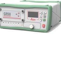
- Rugged Design: Built to withstand harsh environmental conditions, such as extreme temperatures, dust, and water exposure.
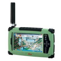
- User-Friendly Interface: Equipped with intuitive software and interfaces for controlling the GNSS system and processing data.
- Integration with Software: Seamless integration with geospatial software for data management, processing, and exporting.
Professionals in construction, agriculture, geodetic surveying, and other industries that require precise positioning and mapping primarily use the vRTK system.
The Hi-Target vRTK GNSS RTK system has many benefits. It is a useful tool for professionals in surveying, construction, and geospatial fields. Here are some key advantages:
1. High Precision
- Centimeter-Level Accuracy: RTK technology provides real-time corrections, ensuring precise measurements essential for tasks like land surveying and construction.
2. Real-Time Data
- Immediate Corrections: Users receive instant feedback and corrections, allowing for more efficient workflows and quicker decision-making.
3. Multi-constellation Support
- Enhanced Reliability: Access to multiple satellite systems (GPS, GLONASS, Galileo, BeiDou) improves satellite visibility and redundancy, especially in challenging environments.
4. Versatility
- Wide Range of Applications: Suitable for various tasks, including topographic surveys, construction staking, precision agriculture, and more.
5. User-Friendly Interface
- Intuitive Design: Modern touchscreen interfaces and compatible software simplify operation and data management, making it accessible for users of different experience levels.
6. Rugged Construction
- Durability: Built to withstand harsh conditions, the system typically features a robust design and environmental protection (like IP67 rating).
7. Portability
- Compact and Lightweight: Easy to transport, making it suitable for fieldwork without adding excessive bulk.
8. Cost-Effective
- Reduced Need for Post-Processing: Real-time corrections minimize the need for extensive post-processing, saving time and resources.
9. Flexible Communication Options
- Multiple Data Link Options: Supports various correction data transmission methods (like NTRIP and radio), allowing for flexibility in different work environments.
10. Integration Capability
- Compatibility with Other Tools: Can often be integrated with other surveying equipment and software for a complete geospatial solution.
GNSS Specifications
- Supported Satellite Systems: GPS, GLONASS, Galileo, BeiDou
- Frequency Bands: L1, L2, L5 (and sometimes additional bands)
- Multi-constellation Support: Yes, to enhance accuracy and reliability
Accuracy
- Horizontal Accuracy: Typically within 1-3 cm (when using RTK)
- Vertical Accuracy: Typically within 2-5 cm (when using RTK)
Communication
- Data Link: RTK correction via various methods (e.g., NTRIP, radio)
- Range: Up to several kilometers depending on the method used
Power and Battery
- Battery Life: Often ranges from 8 to 12 hours on a full charge
- Power Source: Rechargeable lithium-ion batteries
Environmental
- Operating Temperature: Typically from -30°C to +70°C
- Water and Dust Resistance: IP67 or similar rating for ruggedness
User Interface
- Display: Typically includes a touchscreen for easy navigation
- Software Compatibility: Often compatible with various surveying software for data processing
Physical Dimensions
- Weight: Generally around 1-2 kg, depending on the model
- Size: Compact design for portability


Reviews
There are no reviews yet.