


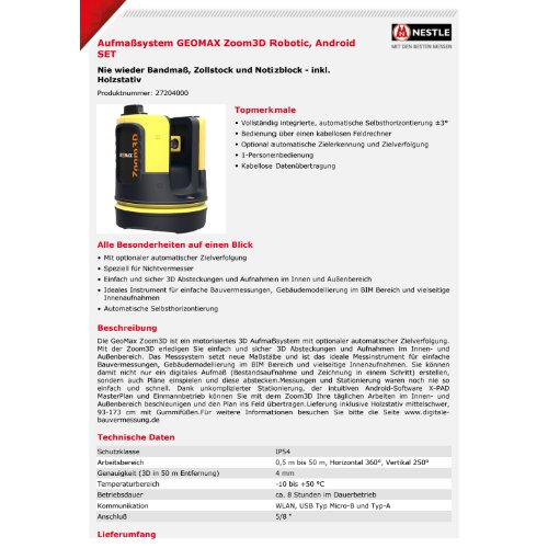
GeoMax Zoom3D Robotic Laser Scanner
The GeoMax Zoom3D is a high-performance, robotic 3D laser scanner used for capturing detailed and accurate measurements of physical environments. GeoMax, a company known for providing high-precision geospatial instruments, offers this device for applications such as land surveying, building and infrastructure documentation, and other civil engineering projects. The Zoom3D scanner is particularly known for its ability to quickly capture a large amount of spatial data, producing highly accurate 3D point clouds.
Features:
- Long Range & High Accuracy:
- The Zoom3D typically has a range of up to 300 meters or more, depending on the environment and specific model.
- It offers high angular and linear accuracy, providing precise point clouds for detailed analysis and modeling.
- 360° Scanning:
- The device performs full 360° scans, capturing data from all directions in the surrounding area, which is ideal for mapping large spaces or complex structures.
- Robotic Operation:
- The robotic feature allows for automatic target tracking, enabling the scanner to follow a target and collect data remotely without manual adjustments.
- It integrates with total station functionality for seamless surveying, increasing efficiency and reducing human error.
- Fast Data Capture:
- The scanner is capable of rapidly acquiring thousands to millions of data points per second. This high scanning speed ensures that large areas can be captured quickly, making it efficient for time-sensitive projects.
- Built-in GPS:
- For georeferencing and real-time positioning, the Zoom3D scanner may incorporate GNSS/GPS capabilities, enabling accurate mapping of survey points in global coordinate systems.
- Ease of Use:
- It typically features a user-friendly interface, often with a touch screen for intuitive control and visualization of scans in real time.
- Integration with software like GeoMax’s X-PAD or third-party software (e.g., Autodesk, Trimble) for post-processing and 3D modeling is often supported.
- Robustness:
- GeoMax scanners are designed for durability, with weather-resistant housings and the ability to operate in challenging environments (rain, dust, etc.).
- Compact and Portable:
- Despite its advanced features, the Zoom3D laser scanner is often compact and portable, allowing surveyors to easily transport and set it up in different locations.
Applications:
- Building and Construction: Creating accurate 3D models of buildings and infrastructures for renovation, maintenance, or construction planning.
- Surveying: Collecting topographical data or performing land surveys in challenging terrains.
- Cultural Heritage Preservation: Scanning historical sites or artifacts to preserve their digital representations.
- Mining: Documenting the conditions of mines or quarries for planning and monitoring.
- Industrial Inspections: Used for scanning factory floors, refineries, and other industrial plants to ensure accurate measurements for maintenance and upgrades.
Advantages:
- Time Efficiency: Scans large areas quickly, reducing fieldwork time.
- Accuracy: High-resolution scans produce highly accurate point clouds, which are essential for detailed planning and analysis.
- Data Richness: The point cloud data collected can be used for creating 3D models, BIM (Building Information Modeling), and other advanced digital representations.
- Remote Control and Automation: The robotic capabilities allow for operation with minimal hands-on interaction, freeing up the operator to focus on other tasks.
Potential Limitations:
- Cost: High-performance laser scanners like the Zoom3D can be expensive, which may be a barrier for smaller operations.
- Post-Processing: While the scanner captures detailed data, the processing of this data (converting point clouds to usable 3D models) may require significant computational resources and software expertise.
- Environmental Limitations: While robust, laser scanners can still face difficulties in highly reflective, transparent, or very dark environments where laser signals might be scattered or absorbed.
Benefits:
1. Increased Surveying Speed
- Fast Data Capture: The Zoom3D can capture thousands to millions of data points per second, enabling rapid surveying of large areas or complex structures. This reduces field time and allows for quicker project turnaround.
- Reduced Labor: The robotic capabilities mean that the device can track targets automatically, eliminating the need for constant manual repositioning by the operator. This increases overall productivity.
2. High Accuracy and Precision
- Precise Measurements: The scanner delivers high angular and linear accuracy, which is essential for creating detailed, reliable 3D models. This is particularly important for engineering, construction, and design projects where exact measurements are critical.
- Long-Range Scanning: The Zoom3D’s ability to scan over long distances (up to 300 meters or more) means that it can capture large areas or difficult-to-reach locations without sacrificing accuracy.
3. 360° Coverage and Detailed Data Collection
- Full 360° Scans: The device can scan in all directions, capturing a complete and detailed representation of the environment without blind spots. This is especially beneficial for mapping complex or densely packed environments such as construction sites, heritage buildings, or large industrial plants.
- Point Cloud Data: The high-density point cloud generated by the scanner allows for highly detailed digital representations of the surveyed area, providing rich data for creating 3D models, visualizations, and analysis.
4. Improved Workflow and Integration
- Robotic and Remote Operation: The ability to remotely control the scanner, track targets, and adjust settings reduces the need for manual intervention, which enhances workflow and minimizes human error.
- Seamless Software Integration: The Zoom3D can be integrated with a variety of software tools, such as GeoMax X-PAD, Autodesk, and other 3D modeling platforms, enabling easy post-processing, analysis, and generation of 3D models or BIM (Building Information Models).
- Real-Time Data Visualization: The device often features a touchscreen interface that allows operators to view scan results in real-time, enabling quick adjustments and improving the quality control process during data capture.
5. Enhanced Data Quality for Analysis and Design
- Precise 3D Models: The data captured by the Zoom3D can be used to create highly accurate 3D models for use in design, construction, and maintenance projects. This improves the decision-making process and can reduce costly mistakes or design errors.
- As-Built Documentation: The scanner is especially valuable for capturing as-built documentation of structures, making it easier to compare the actual state of a building or infrastructure with the planned designs, which is vital for renovation and retrofitting projects.
6. Portability and Ease of Use
- Compact and Lightweight: Despite its advanced capabilities, the Zoom3D is designed to be relatively compact and portable, making it easy for surveyors to transport the equipment to various locations.
- User-Friendly Interface: The interface is designed to be intuitive, allowing operators to quickly familiarize themselves with the system and start collecting data. This minimizes the learning curve and allows even less-experienced surveyors to use the equipment effectively.
7. Robust and Reliable in Various Environments
- Durability: The GeoMax Zoom3D is built to withstand tough environmental conditions, such as dust, rain, and varying temperatures, making it suitable for outdoor use in challenging environments.
- Weather Resistance: The device can operate effectively in different weather conditions, meaning surveys can continue even in adverse conditions, reducing downtime and delays.
8. Cost Savings
- Reduced Field Time: By speeding up the data collection process, the Zoom3D reduces the amount of time needed for site visits, which directly translates into cost savings for project teams.
- Minimized Errors: The high accuracy and automated tracking features reduce human error, minimizing costly mistakes in measurements that would otherwise require rework or additional field trips.
9. Improved Safety
- Remote Operation: With its robotic tracking and remote control features, operators do not need to be in close proximity to the scanning device during operation. This increases safety, especially in hazardous environments like construction sites, industrial plants, or areas with limited access.
- Non-Intrusive: The laser scanning process is non-contact and non-invasive, allowing surveyors to gather data without disturbing the environment or structure being scanned.
10. Versatility Across Applications
- Versatile Use Cases: The Zoom3D can be used across a wide range of industries, including construction, architecture, engineering, mining, surveying, heritage preservation, and industrial inspections, offering flexibility for many different types of projects.
- High-Quality Data for Multiple Deliverables: The high-quality data from the scanner can be used for diverse purposes, including creating 3D models, point clouds for design software, visualizations for planning, and even virtual walkthroughs.


Reviews
There are no reviews yet.